Continent North America
Region Northern America
Coordinates 60°00′N 95°00′W
AreaRanked 2nd
• Total 9,984,671 km2 (3,855,103 sq mi)
• Land 91.08%
• Water 8.92%
Coastline 202,080 km (125,570 mi)
Borders 8,893 km
Highest point Mount Logan,
5,959 m (19,551 ft)
Lowest point Atlantic Ocean, Sea Level
Longest river Mackenzie River,
4,241 km (2,635 mi)
Largest lake Great Bear Lake
31,153 km2 (12,028 sq mi)
Climate
temperate in south to subarctic or arcticin north
Terrainmostly plains with mountains in west and lowlands in southeast
Natural Resourcesiron-
ore, nickel, zinc, copper, gold, lead, molybdenum, potash, diamonds, silver, fish, timber, wildlife, coal, petroleum, natural gas, hydropower
Natural Hazards -
permafrost, cyclonic storms, tornadoes, forest fires
Environmental Issuesair and water pollution, acid rains
Canada is the second largest country in the world, smaller only to Russia.
Population: 28 million people
Geographic size: 3.9 million square miles
Capital: Ottawa
Major cities and population: Toronto, Montreal, Vancouver, Calgary, Edmonton, Winnipeg, Halifax
Population: 28 million people
Geographic size: 3.9 million square miles
Capital: Ottawa
Major cities and population: Toronto, Montreal, Vancouver, Calgary, Edmonton, Winnipeg, Halifax
Geographic LandmarksTop of Page
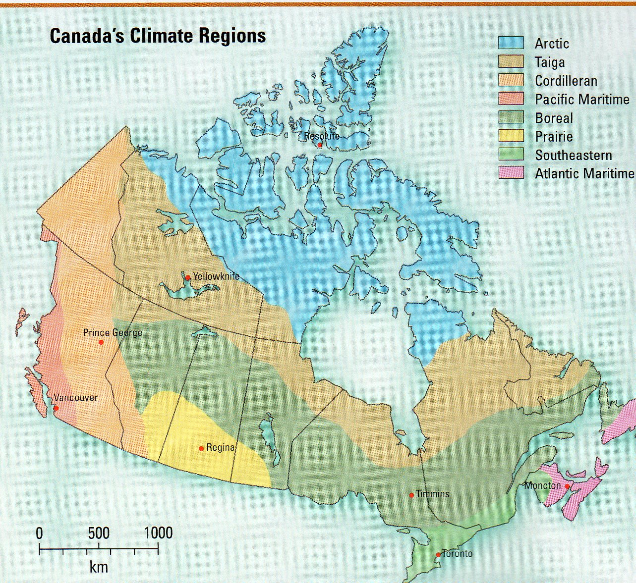
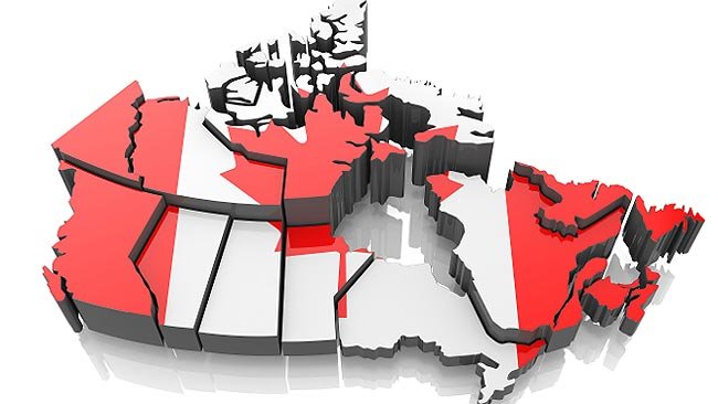
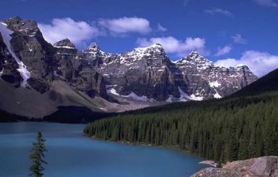
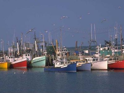
Canada has a very large and diverse range of geographic features. Canada is divided into 10 provinces and 2 territories. Canada stretches from the Pacific Ocean on the west, to the Atlantic Ocean on the east. Northern Canada reaches into the Arctic Circle, while southern Canada stretches below the northern points of the United States. Canada has a very small population, 28 million people, for its geographic size. Much of Canada is still wilderness, cover by forests. The Rocky Mountains cover a major part of western Canada -- British Columbia, the Yukon Territory, and the western part of Alberta. West-central Canada is mostly prairie, consisting of large grain farms. The east-central part of Canada are the provinces of Ontario and Quebec. These are major population and industrial areas. The Maritime provinces on the east coast rely very heavily on the Atlantic Ocean for their way of life. |
ClimateWith Canada being so large, the climate varies considerably throughout the country. Canada is generally known for its cold winters and hot, but short, summers.
1. If long walks on the beach are your thing, Canada’s the place to be. The country’s 243,000 km of coastline are the longest in the world. At a pace of about 20 km each day, the stroll would take 33 years. The shores of 52,455 islands are a big part of what makes the coastline so long.
2. With water flowing out from the Great Lakes, the largest source of freshwater in the world, it’s little wonder the St. Lawrence maritime estuary (a place where fresh and saltwater mix) is one of the largest and deepest estuaries in the world. Freshwater increasingly mixes with saltwater for nearly 250 km, from Île d’Orléans, near Quebec City, to Pointe-des-Monts, northeast of Baie Comeau on the St. Lawrence River’s north shore.
3. The oldest known rocks on Earth — 250 million years older than any other known rocks — are found in Canada. The 4.28-billion-year-old rock was discovered by geologists in 2001 in an area of exposed bedrock on the eastern shore of Hudson Bay, in northern Quebec.
4. The largest known impact crater in Canada (and the second-largest on Earth) is found near Sudbury, Ontario. Known as the Sudbury Basin, the crater is 130 km in diameter. It is believed that the impact of a 10 km meteorite created the Sudbury Basin in just seconds about 1.85 million years ago.
5. Our pingos are bigger than yours. The Northwest Territories’ Mackenzie Delta region is home to the world’s greatest concentration of pingos (some 1,350) and the largest. A pingo is an ice-cored hill, usually conically shaped, that grows only in permafrost. They’re formed when water freezing under the surface is forced up by pressure, and they range from a few metres to several tens of metres high.
6. There are millions of lakes in Canada, so it’s hardly surprising that our nation has more lake area than any other country. They’re often big, too, with 563 lakes larger than 100 square km.
7. Water so buoyant it’s impossible to sink? Head to the Dead Sea, right? Or go to central Saskatchewan’s Little Manitou Lake. Fed by underground springs, the 13.3 square km lake has mineral salt concentrations of 180,000 mg per litre, making the water extremely buoyant.
8. Ontario’s Wasaga Beach is the longest freshwater beach in the world. It stretches 14 km along the shore of Lake Huron’s Georgian Bay. That’s a whole lotta sand!
9. At a latitude of 50°26' and a longitude of 104°37', Regina is the Canadian city closest to the geographical centre of North America.
10. The nation’s only officially bilingual province? New Brunswick, where about 33 percent of people speak French.
- Canada is the second largest country in the world.
- The highest tides in the world occur in the Bay of Fundy in New Brunswick.
- The capital of Canada is Ottawa, the second coldest capital in the world.
- Canada has ten provinces and three territories.
- Canada has the longest coastline of any country in the world at 243,977 kilometers – 151,600 miles.
- Montreal is the world’s second largest French speaking city after Paris.
- Six cities in Canada have a population of over 1 million: Toronto, Montreal, Vancouver, Calgary, Edmonton and Ottawa.
- Canada is lucky to have 9% of the world’s renewable water supply!
- The largest non-polar ice field in the world can be found in the St. Elias Mountains, Yukon Territory. It covers an area of 40 570
- square kilometers of which 16,900 square kilometers are located in Canada, the remainder being in Alaska.
- Canada has six time zones.
- The longest highway in the world is the Trans-Canada Highway which is over 7604 kilometers (4725 miles) in length.
- The world’s most northerly sand dunes are in Athabasca Provincial Park in northwest Saskatchewan. They are 30 meters high.
- Half of the country is covered with forests, which should come as no surprise considering one-tenth of the world’s forests are here.
- The highest mountain in Canada is Mount Logan, Yukon Territory, 5959 meters (19,551 feet).
- Wasaga beach is the longest fresh water beach in the world.
- Despite being a huge country, Canada has the fourth lowest population density in the world, with only three people living per square kilometer! Almost half of the population in Canada were born in other countries.
- The coldest temperature ever recorded in Canada was -63C (-81.4F) on February 3, 1957 in Snag, Yukon.
- Alert, in Nunavut Territory, is the northernmost permanent settlement in the world.
- The highest waterfall in Canada is Della Falls, British Columbia, 440 meters high (1444 feet).
- The border between Canada and the United States is officially known as the International Boundary. It is 5,525 miles long, including the 1,538 miles between Canada and Alaska. It’s the world’s longest unprotected border.
- Ocean Falls, British Columbia has on average 330 days of rain per year. Yuck!
- Estevan, Saskatchewan is reportedly the sunniest place in Canada with 2,537 hours of sunshine per year.
- Nakwakto Rapids, Port Hardy’s legendary dive destination, boasts the strongest current in the world – with speeds of up to 18.4 miles per hour.
- Three of Canada’s islands make the top ten for size in the world – Baffin, Ellesmere and Victoria.
- Manitoulin Island is the largest freshwater island in the world.
- Two of the largest lakes in the world are found in the Northwest Territories – Great Bear Lake and Great Slave Lake.
- Nunavut takes up one fifth of Canada’s total land area.
- Calgary is famous for its’ Chinooks – a weather phenomenon that can raise the temperature by 10 degrees in a matter of minutes.